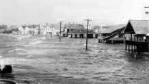
Hurricane Carol was one heck of a storm. The category 3 hurricane made landfall near Groton and brought devastating flooding and wind damage to parts of southeastern Connecticut and Rhode Island (from South County to Providence). Carol is a bit forgotten – the impact was less than 1938 and it was overshadowed in the state by the remnants of Connie and Diane in 1955 that paralyzed the state with a biblical flood.
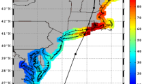
The reanalysis by Chris Landsea and the work by Jarvinen shows a landfall of Carol near Groton. This is about 20 miles east of the “Best Track” landfall location in Old Saybrook. The reanalyzed landfall location makes sense given the damage documented in Connecticut.
Carol made landfall on the morning of August 31, 1954. The storm brought category 2 force winds (sustained near/over 100 mph) in Groton and Stonington and a vicious storm surge. In New London the storm tide reached 9.6 ft MLLW, only exceeded by the 1938 storm which was 10.6 ft MLLW. The surge in New London at the tide gauge was 6.5 feet though a study by the Army Corps of high water marks after Carol revealed surges of 8-10 feet were common throughout southeastern Connecticut. In Stamford – many miles from the landfall location – the storm tide reached 10.3 ft NGVD which was only exceeded by Sandy and the 1938 hurricane.
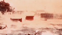
Hurricane Carol is widely viewed to be the “most tropical” of hurricanes to hit Connecticut. What’s meant by that is that while the storm was likely going extratropical transition – Carol was the most purely tropical of the storms to strike Connecticut. Here’s one example of that – take a look at this picture taken from the old Griswold Hotel in Groton near the mouth of the Thames River.
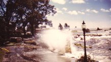
The storm had a classic “eye” and the precipitation distribution from the storm – both east and west of the storm track – was relatively symmetrical. That’s very unusual for a landfalling New England hurricane!
In Bridgeport the monthly climate report indicates 1.62″ of rain fell on the day with a peak sustained wind out of the NNE at 40 mph with a gust to 60 mph. The report read as follows “Hurricane Carol did extensive damage to the shorelines of Connecticut. Storm center passed 50 miles east of station. Lowest pressure noted at 0920 EST, with NNE winds of 40 MPH and gusts to 60 MPH noted at 0928 EST. Airport was inundated with a maximum of 2 feet of water.” The lowest pressure reading in Bridgeport was 28.87″.
In Hartford at Brainard 2.36″ of rain fell. No wind data was recorded. In New Haven at Tweed 2.63″ of rain fell with a sustained wind of 38 mph out of the northeast. The report read “Heavy storm on the 31st. Gusts to 65 MPH 9-10 A.M. Caused heavy water manage along shore. Lowest pressure 28.77″ 9:10 A.M.”
At Windsor Locks 1.95″ of rain fell with a suatained wind of 56 mph out of the northwest! A 64 mph wind gust was recorded in the monthly report.
Cooperative observer reports for August 1954 include some interesting highlights.
- Baltic, CT recorded 4.10″ of rain “HURRICANE” was listed in the important wx conditions space.
- Brooklyn, CT recorded 4.00″ of rain
- The observer in Colchester wrote a great blurb about Carol – though I can only decipher about half of it!
- The Danbury coop observer reported wind gusts near 60 mph
- In Derby the coop observer reported the following “High winds on Aug. 31. Hurricane “Carol” considerable damage to trees. An additional amount of rain – 1.05″ fell from 8:30 a.m. to 12:30 p.m. on Aug 31″ That 1.05″ is in addition to the 1.56″ reported at 8:30 a.m. in Derby.
- Even in Falls Village the observer mentioned the wind on the 31st “wind on the 31st caused considerable damage to untilities.”
- In Groton the observer wrote “Aug 31. Winds of hurricane force from 9:00 A.M. to 11:30 A.M. did much damage to buildings, trees, and boats in this area. Power and telephone lines severely damaged causing loss of service for several hours.”
- In Mansfield at the dam the coop observer from the Army Corps mentioned on the 31st “Note: temperature readings may be inaccurate because the box blew over during height of storm”
- Here’s what the Middletown observer wrote:
- Here’s the observer’s remarks in New London at Fort Trumbull.
- In Norfolk, observer Norman Smith summarized Carol this way, “The feature of the month that was most notable was the passage on the 31st of an Atlantic hurricane. The storm here brought 2.59″ of beneficial rain with shifting gale winds from the E NE and NW. There was some damage to power and telephone lines and roads were blocked by uprooted trees and branches.”
- In Putnam 4.25″ of rain fell and the observer noted the hurricane passed east of Putnam with considerable damage to crops and trees with some property damage.
- In Storrs 3.35″ of rain fell. The observer wrote, “On the 31st of August Hurricane “Carol” hit eastern Connecticut hard with 60 mile wind – higher gusts – and nearly 2″ of rain between 8 and 11 a.m.
- 4.36″ of rain fell in Westbrook – here’s the observation remarks.
The observations show a core of very heavy rain – 4″-6″ of rain near the center of the storm with less rain on the western periphery. Again this symmetry is unusual and shows that the eyewall was likely quite in tact and the storm was still quite “tropical” at the time of landfall.
Carol produced $50,000,000 in damage in 1954 dollars in Connecticut and killed 65 across New England. The storm is the only category 2 to strike Connecticut in modern times (1938 was a category 3 in Connecticut) and remains the strongest storm to strike the state in the last 59 years.

