
The first weekend of February started with colder weather and snow is possible on Sunday.
By Sunday morning, temperatures could feel closer to 0 degrees.
Groundhog Day will see clouds enter back into the picture, so we're predicting that Chuckles, Scramble and Beardsley Bart will not see their shadow tomorrow.
Get top local stories in Connecticut delivered to you every morning. Sign up for NBC Connecticut's News Headlines newsletter.
That would lead to their early spring prognostication, but snow is likely before their day is over.

Small snow accumulations are possible through Sunday night. The snow would likely develop after dinnertime with the heaviest snow showers between 9 p.m. and midnight.
One to two inches of snow look possible for most locations away from the shoreline with the highest totals in northern Connecticut. Locally higher amounts, perhaps closer to 3 inches, could be possible in a few communities in the NW Hills or in northeastern CT.

The snow will taper off by 3 a.m. Monday.
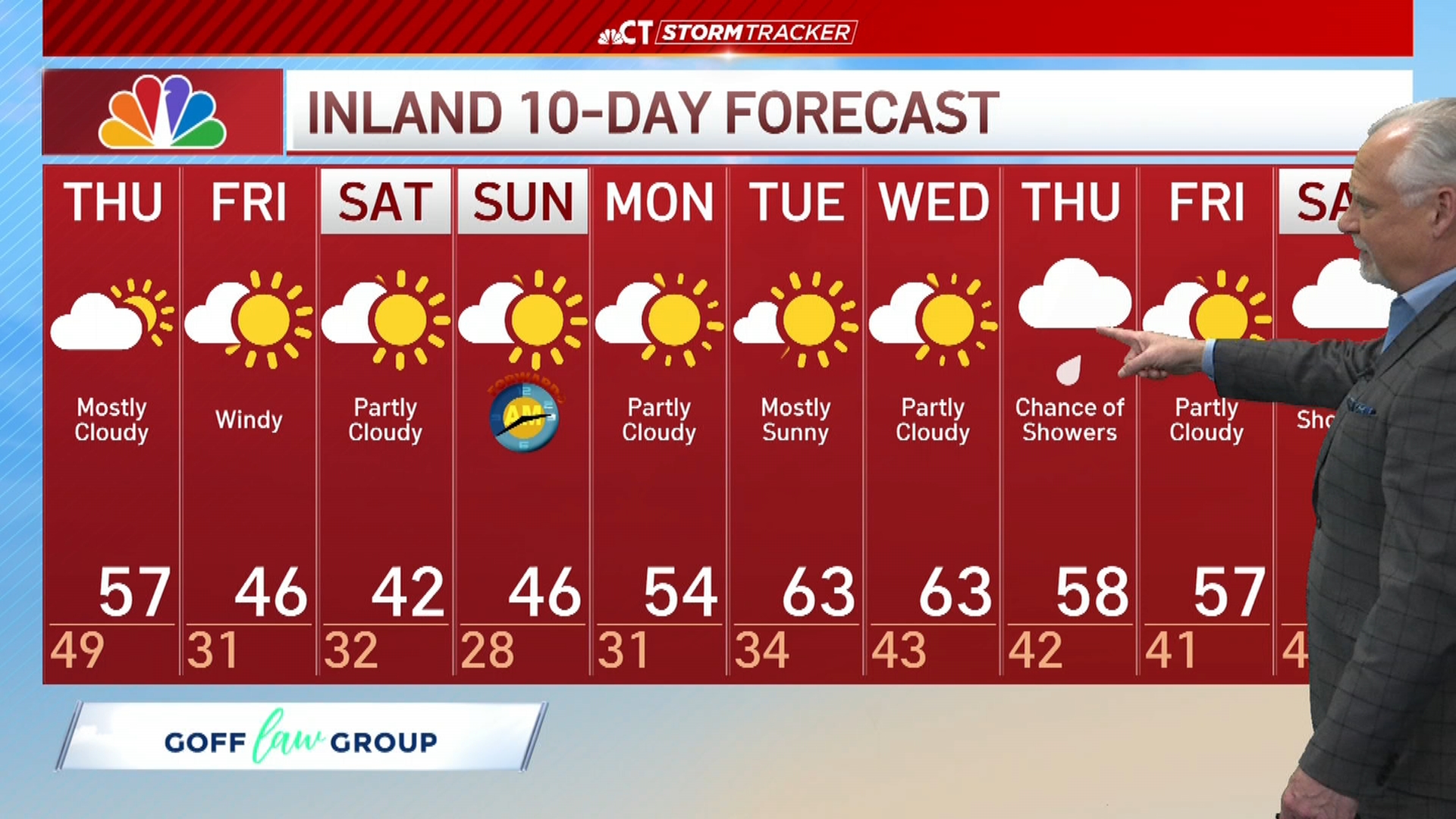
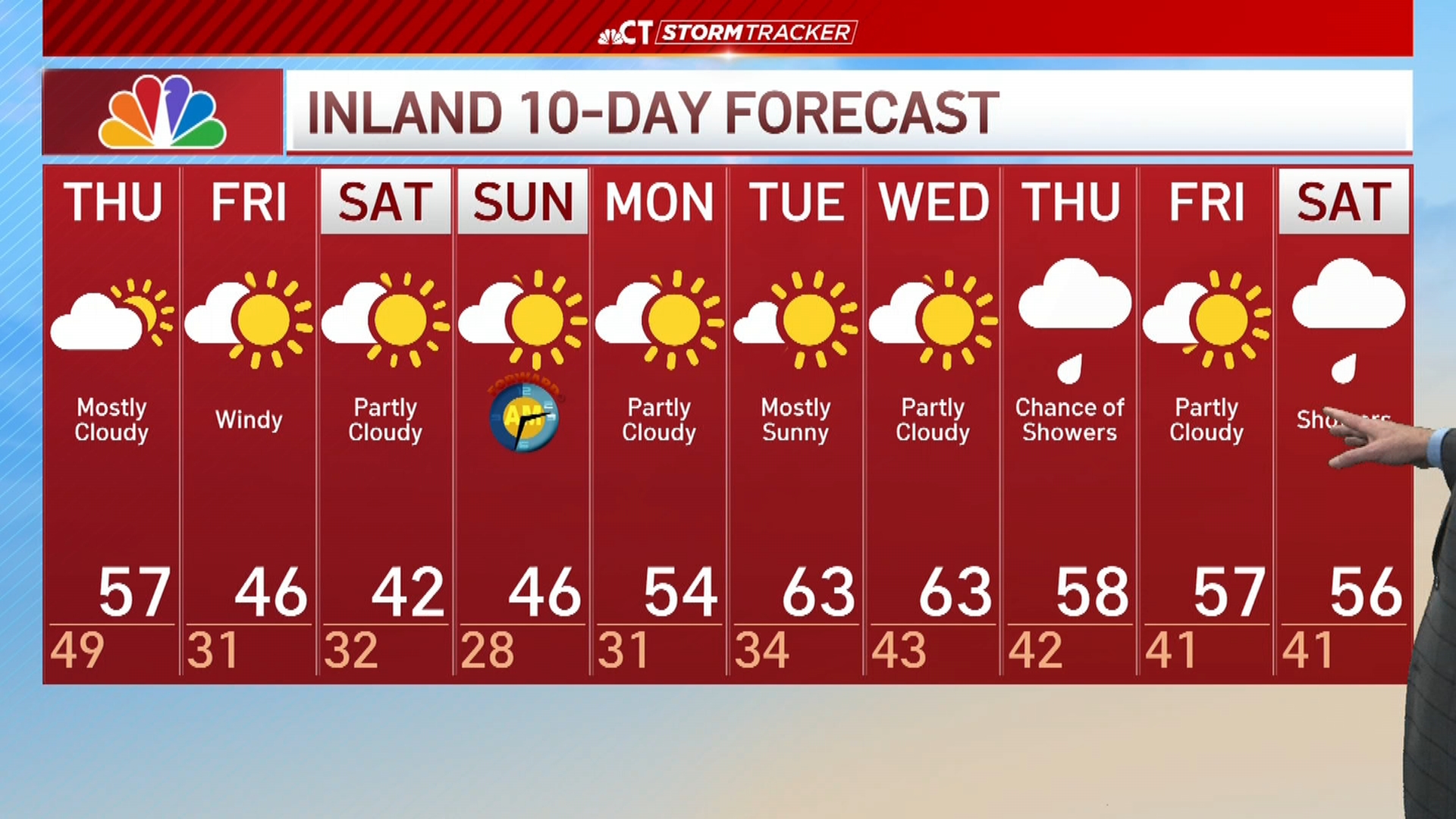
Highs for Monday and Tuesday will be in the mid to upper 40s.