


Monday Night Weather Blog
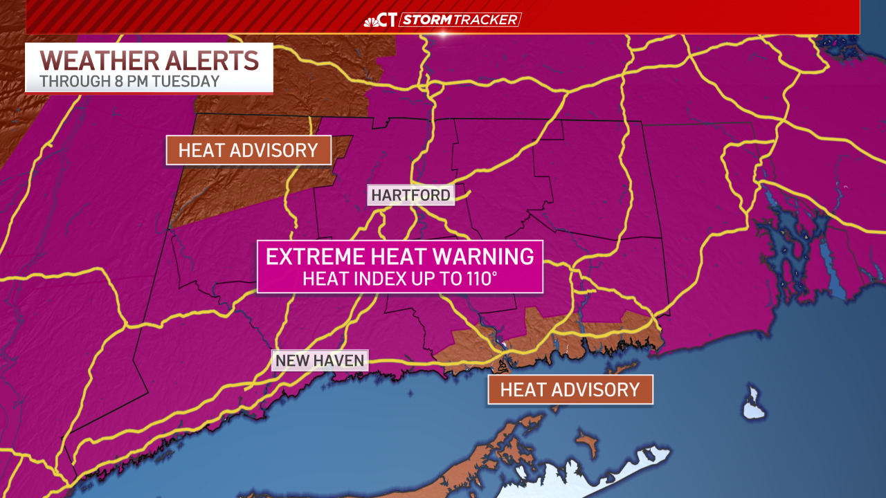
An Extreme Heat Warning continues through Tuesday evening, due to the potential for heat index values to reach 110 degrees. Continue to stay safe in the heat by staying shaded and hydrated as much as possible.
Stream Connecticut News for free, 24/7, wherever you are.


Very little relief will be felt the next couple of nights, including currently during these overnight hours. Low temperatures will only fall into the mid to low 70's by Tuesday morning.
Get top local Connecticut stories delivered to you every morning with the News Headlines newsletter.


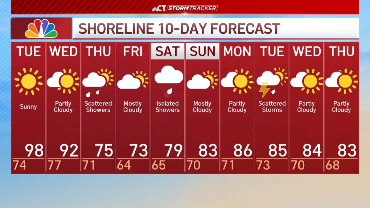
Get ready for another scorcher Tuesday. Abundant sun will be accompanied by hazy and humid weather conditions, making it feel like the low 100's as early as 11 a.m.
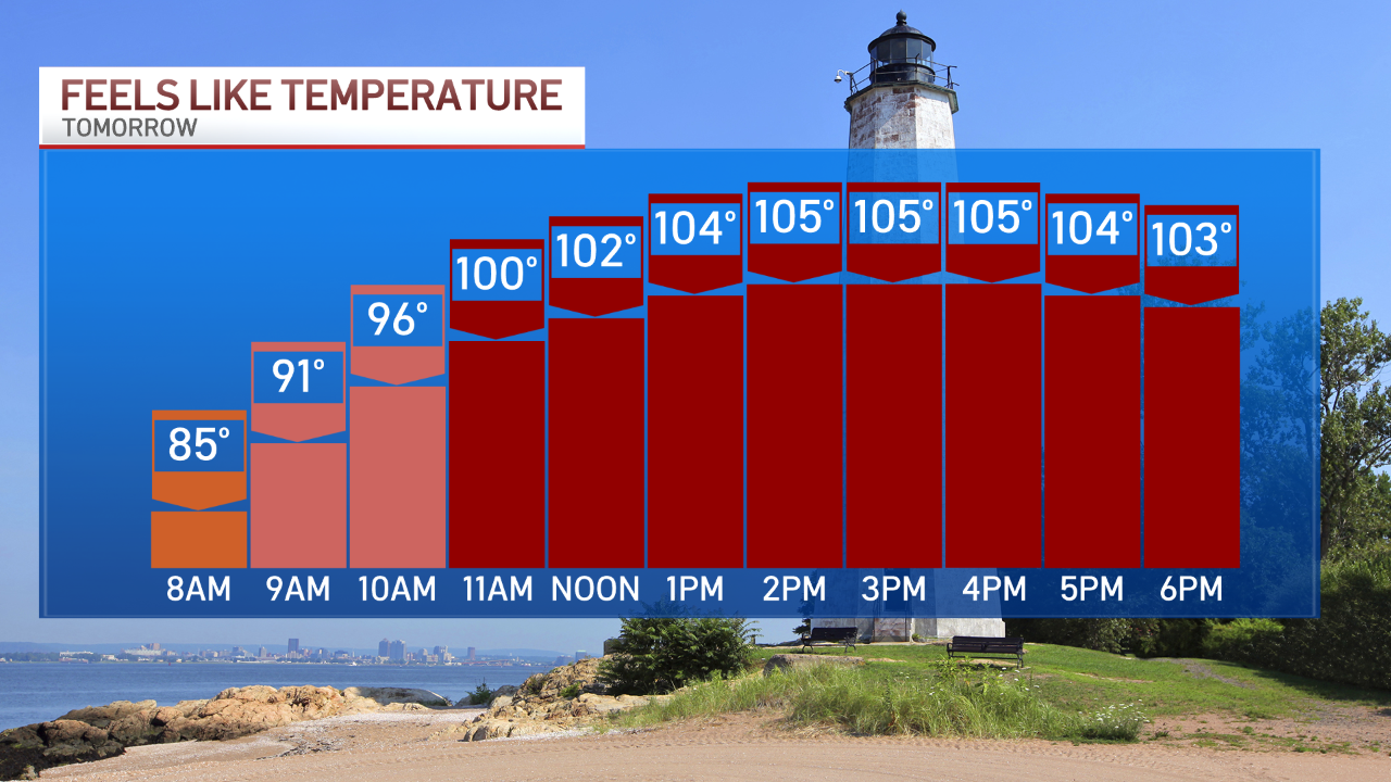
Actual temperatures will warm to near 100 degrees on Tuesday. If we hit 100 degrees in Hartford Tuesday, it would be the first 100-degree day since 2019, and the earliest occurrence of a 100F in a calendar year (on record). Wednesday will be another scorcher, but it will turn drastically cooler Thursday.

Along with the cooler temperatures, scattered rain showers will be likely late Wednesday night through Thursday.

