


Tuesday Weather Blog
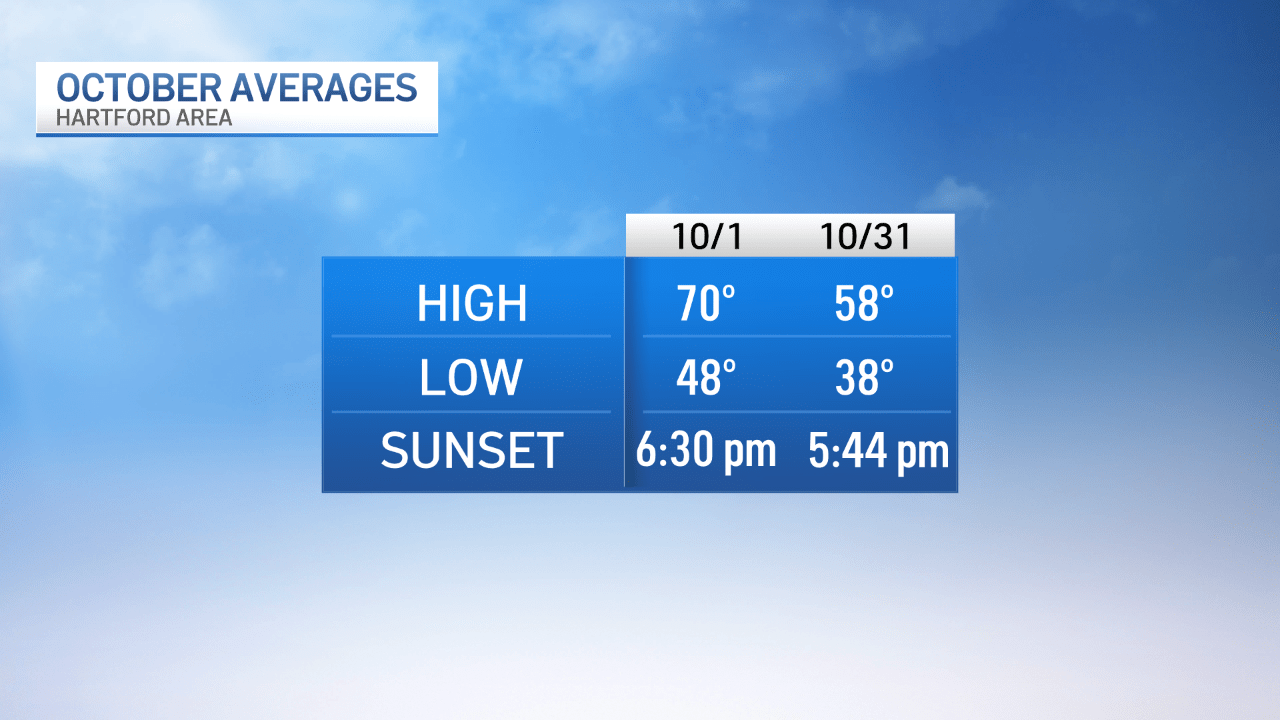
Welcome to October! This is the month where our average high starts around 70 degrees and ends up 58 degrees by Halloween.
We experienced one of the driest Septembers on record. That dry weather looks to roll right into the new month.


Get top local stories in Connecticut delivered to you every morning. Sign up for NBC Connecticut's News Headlines newsletter.
Another decent day is on the way to start October. A mix of clouds and sun with slightly cooler air - highs will only peak in the upper 60s to low 70s with an east wind continuing off of the ocean. If we once again see a little more sunshine, temperatures could be a bit warmer.

A cold front will approach the area on Wednesday, an isolated shower could be possible but it's looking like much of the moisture will dry up by the time it gets to CT. Skies look to stay mostly cloudy with afternoon temps near 70°.

Behind the front, high pressure brings us another dry stretch of weather for Thursday and Friday. By Friday we'll see more sunshine and warmer temps into the mid to upper 70s.
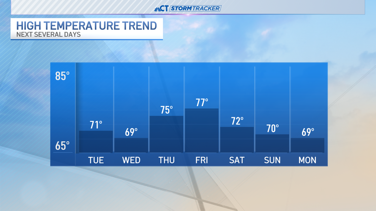
We'll be keeping an eye on the weekend, a few showers look possible for Saturday. At this point, the bulk of the showers could stay to our north as a system quickly moves through the northeast.


Here is how October looks in terms of averages.
The tropics remain active. Several areas are being watched for possible development. Unfortunately, one of those areas could be along the Gulf of Mexico over the next 7 days.
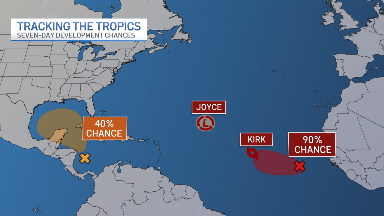
A new tropical storm, Kirk, formed around midday Monday. It's expected to strengthen into a major hurricane but is also expected to stay out to sea through at least the end of the week.

Here is an update on hurricane season names. The next storm to form will be Leslie.

As we get set to close out the month of September, fall foliage is beginning to pop across the state. Some peak is already being observed in the mountains in northern New England.


