


Sunday Weather Blog
Our extremely dry stretch of weather continues... while the Red Flag Warning has expired the elevated fire danger will continue through the weekend.


Today, expect another sunny day with temperatures that are back closer to seasonable levels. The average high temperature for the final Sunday of October is 59 degrees.
Get top local stories in Connecticut delivered to you every morning. Sign up for NBC Connecticut's News Headlines newsletter.

Winds Sunday are expected to be slightly calmer with sustained winds in the afternoon between 5-15 mph with gusts up to 20 mph.

Expect another seasonable day on Monday with highs in the mid to upper 50s.

A warming trend is expected to begin on Tuesday and last for the rest of next week. Highs by Halloween are expected to reach the low 80s for inland Connecticut and mid to upper 70s for the shoreline.

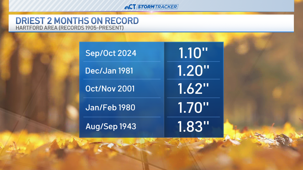
With no substantial rain in the forecast, we are still on track for the driest 2-month stretch on record.
We could end up seeing a few showers as we move into the first full week of November but rain totals look minimal and wouldn't do much to fill the deficit we're currently in.


