


Monday Weather Blog
A storm system has moved east of us in Connecticut....the bigger threat for showers was this morning, but we've seen a few afternoon showers as well as sunny breaks. Seasonable highs in the 60s were felt across the board. Northwest winds gusted around 20-25 mph today.
A mainly clear night is on the way, which will allow morning temperatures to cool back into the 30s for many.


Get top local stories in Connecticut delivered to you every morning. Sign up for NBC Connecticut's News Headlines newsletter.
We have frost advisories issued for Tuesday morning. Be sure to tend to temperature-sensitive crops before temps drop tonight.

Although the clouds won't completely clear from our skies on Tuesday, more sunshine is expected.


Depending on where you live, we could see a few frosty mornings this week as multiple days will start in the 30s.

We will ride the temperature roller-coaster this week and fair weather will dominate the weather theme this week, and maybe next week too!

We expect temperatures in the 70s later this week...but as today's storm flies by it will bring some wet snow to the mountains to our north. Whiteface Mt near Lake Placid, Mt. Mansfield near Stowe, and Mt. Washington will all see snow today.

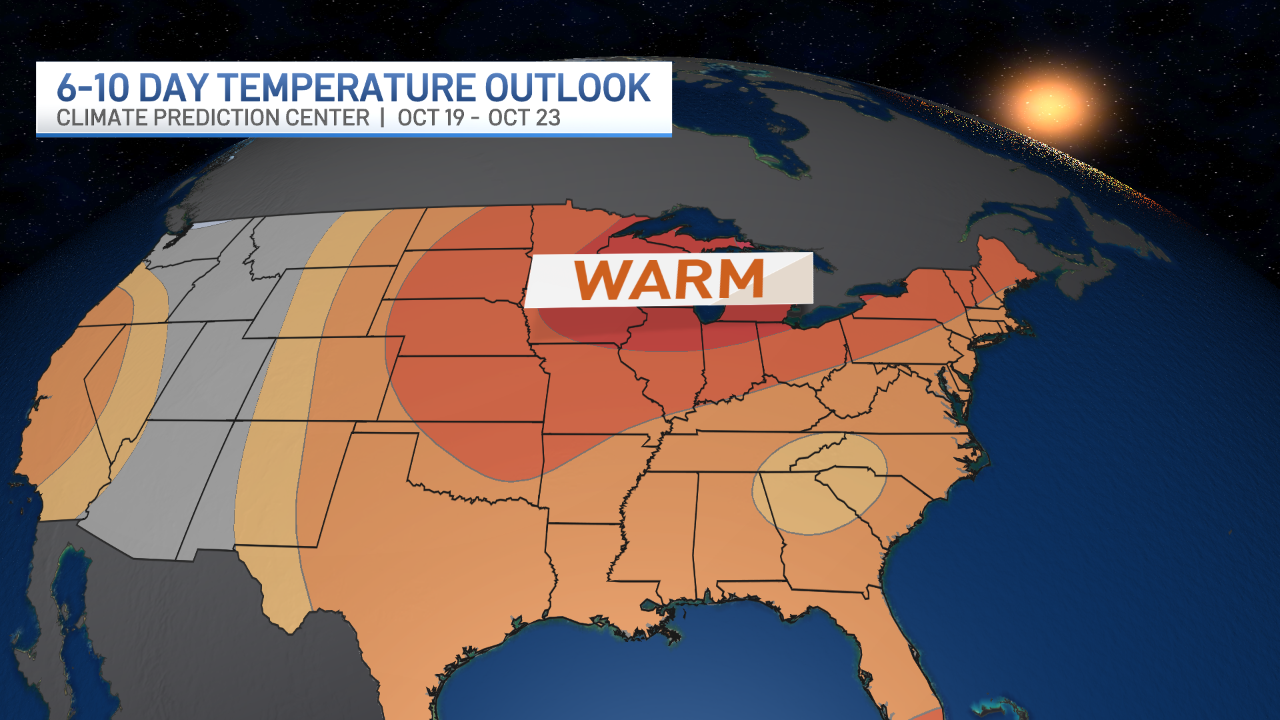
What a look to our 6 to 10 day temperature outlook!! October warmth....for a while!
Our celestial wonders continue....we had the April Eclipse, the recent Auroras, and now a comet visible to our naked eye! After sunset, look west and you might just catch a glimpse. Jennifer caught it.


