


Sunday Weather Blog
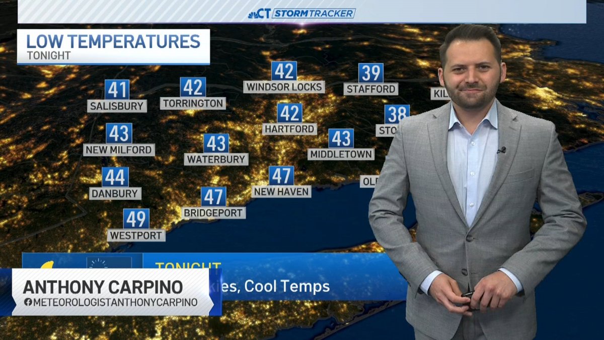
Clear skies and calmer winds are expected overnight as temperatures drop into the low 40s. Some areas, especially in the cooler spots of northwestern and northeastern CT, may wake up on Monday morning to temperatures in the upper 30s.
Stream Connecticut News for free, 24/7, wherever you are.


Monday will see highs in the 70s again with a lot of sunshine. However, clouds return late in the day ahead of our next potential rain system.
Get top local Connecticut stories delivered to you every morning with the News Headlines newsletter.


Tuesday will be mostly cloudy with the chance for a few rain showers to the south late in the day. This is due to a low pressure system over the southeast U.S. that has the chance to provide a few chances through the middle of the week.

On and off showers are expected both Wednesday, Thursday, and potentially lasting into the upcoming weekend.

Right now, signs are pointing to the highest rain totals staying to our south and west. We also know that this system will NOT be a washout in southern New England.
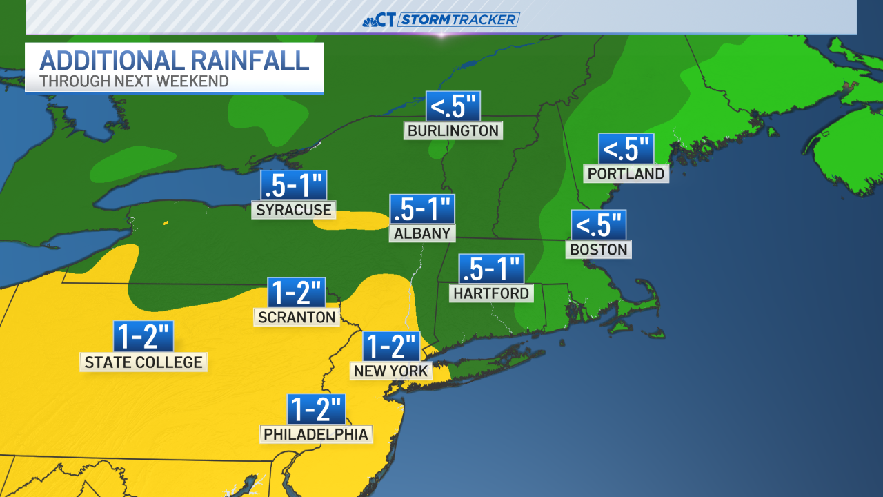
Still, any rainfall will aggravate the already high Connecticut River. There is a flood warning for the river across the entire state until further notice. It's expected to crest by Tuesday.


