


Friday Weather Blog
A Flood Watch is now in effect for all of Connecticut through Saturday morning. This is due to all of the rain that we've seen over the last few days and the additional 1-3" of rain possible through Friday.
Stream Connecticut News for free, 24/7, wherever you are.


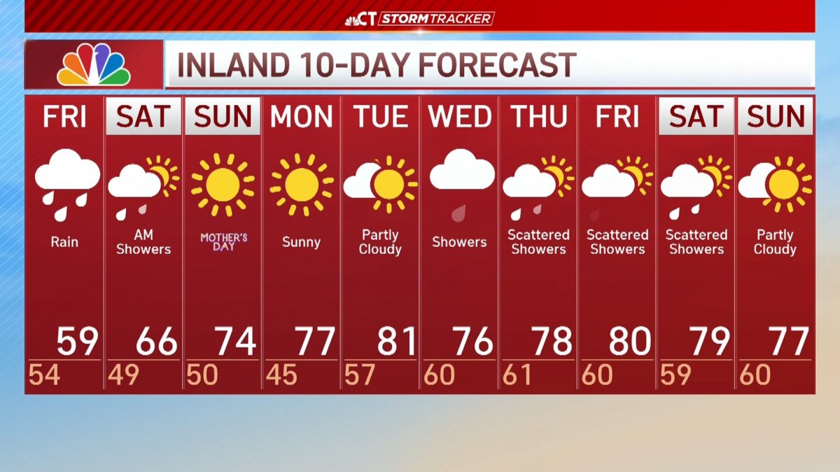
Temperatures will only warm into the 50s and 60s today as waves of steady rainfall continue across the state. Rain could even be a little heavy at times, especially during a few thunderstorms later today.
Get top local Connecticut stories delivered to you every morning with the News Headlines newsletter.


Rainfall will become less widespread overnight as temperatures drop into the 40s and 50s. Scattered showers are still possible through Friday night and even into Saturday morning.

With an additional 1-3" expected today, we'll need to monitor areas that are more prone to flooding. This includes the Connecticut River, which will likely crest early next week.


A few lingering showers are possible for inland Connecticut tomorrow morning, especially near the Massachusetts border. Skies will gradually clear through Saturday with highs in the 60s.

The shoreline and southern Connecticut will dry out tonight and stay that way through the weekend. Mother's Day will see sunshine and highs in the 70s!

Conditions remain dry through Sunday, Monday and Tuesday. Rain chances will return by the middle of next week with highs in the 70s.


