
Sunday Weather Blog
Waves of showers are expecting this evening and into the morning. It might take until the morning for eastern areas of the state to see the rain, but once showers are here, they're going to stick around for a while.
Stream Connecticut News for free, 24/7, wherever you are.
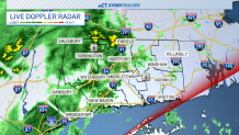
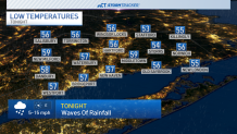
Temperatures will drop into the 50s tonight with scattered showers.
Get top local Connecticut stories delivered to you every morning with the News Headlines newsletter.
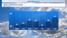
Monday afternoon temps are only expected to reach the low 60s with more rainfall expected.
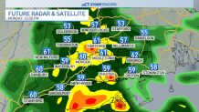
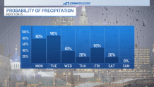
The next three days will be rather unsettled with periodic rain. Some of the rain could be heavy on Monday and Tuesday. We will have some dry time, but not a lot as it will be a cloudy and rainy start to the week.
Widespread rainfall amounts of 2-4 inches appear likely for much of the state through Wednesday afternoon, possibly more than 4" in a few spots.
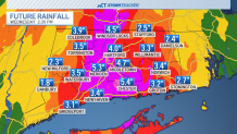
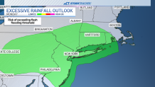
This will have our rivers running at elevated levels and minor flooding could be possible.

We should start to dry out Wednesday evening and through the day on Thursday with temperatures a little warmer in the low 70s.
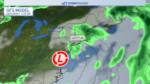
Unfortunately, the risk for rain will go back up by Friday. How much rain and how widespread it could be is still uncertain with a large spread between the models. The European model favors another strong low with widespread rainfall Friday into Saturday.

The American model produces a weaker low with only a few scattered showers.
A few showers may linger into Saturday but overall the Mother's Day weekend looks to be dry. Mother's Day itself looks warmer with highs in the mid 70s.
Local

There will be plenty of tweaks made to the forecast over the next several days so check back in for a forecast update or download the free NBC CT app and stay updated on the go.